hamendall world map
technology used
Inkarnate
Adobe Photoshop
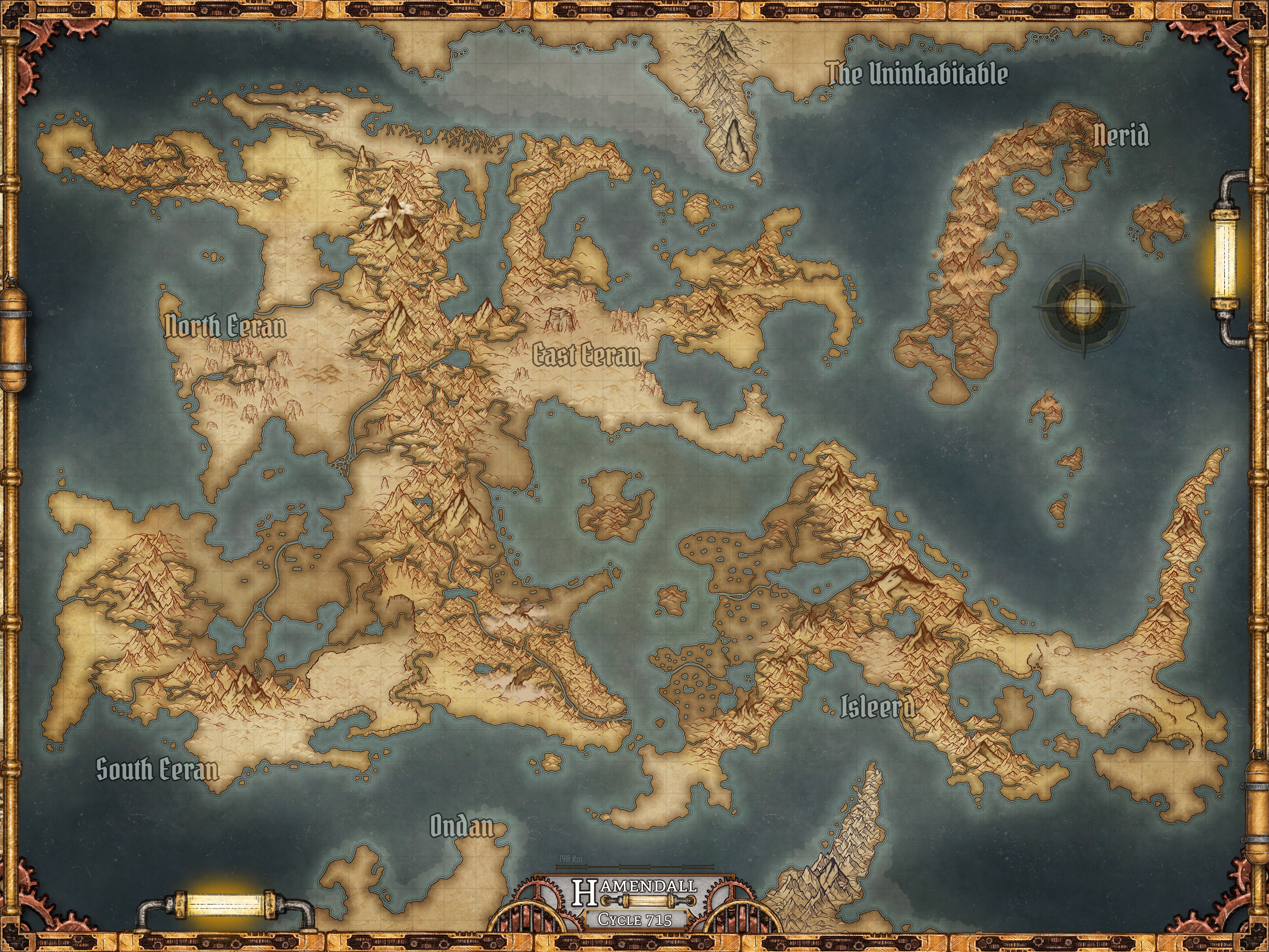
final map
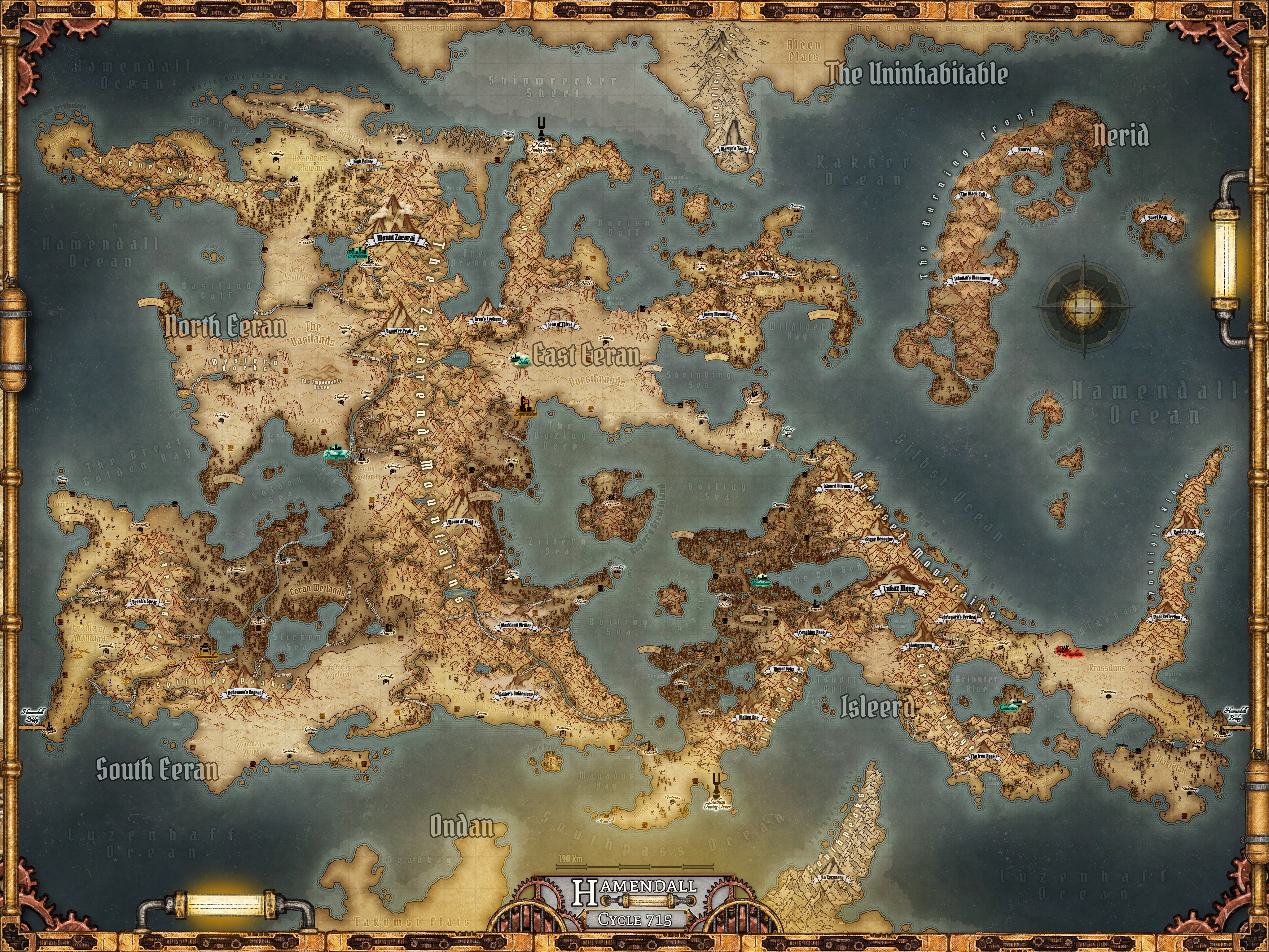
This is the final product of the process seen below. As a wasteland, Hamendall lacks the ecological diversity of other similar planets, like Earth, but maintains complex and interesting geography and climates. I'm pretty proud of the amount of detail I managed to pack into this map and even more proud of the worldbuilding it opened the door for.
original drawings
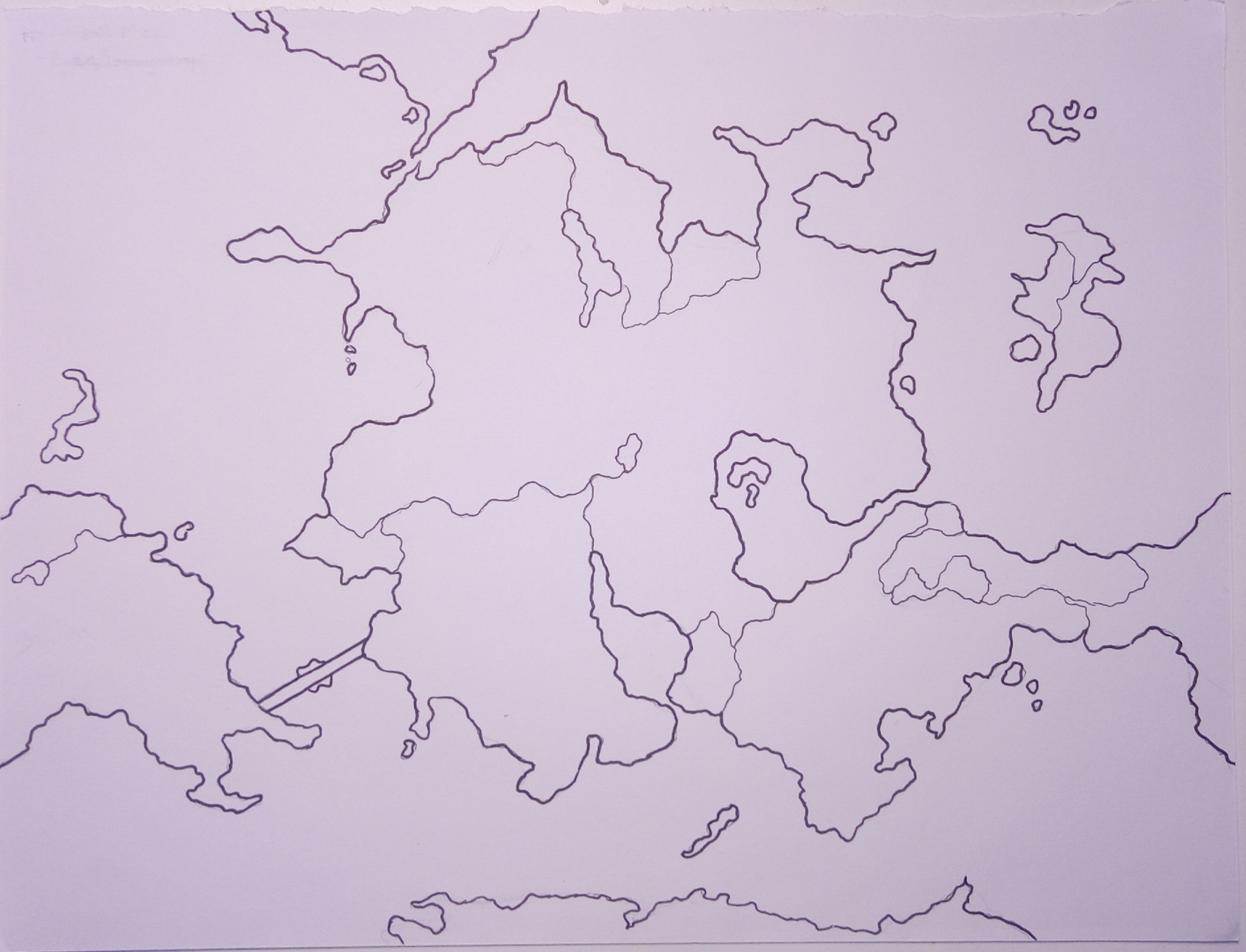
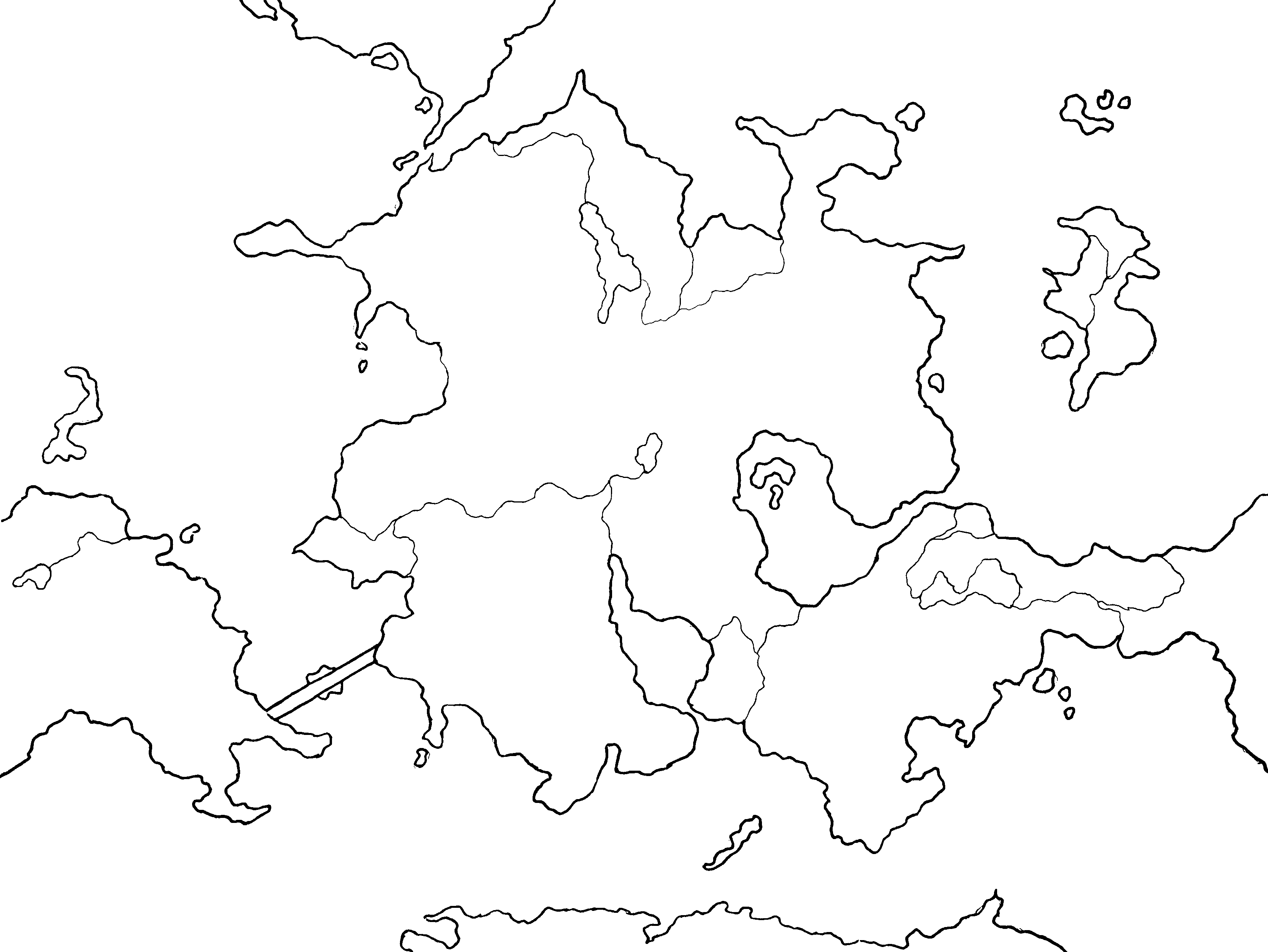
My first attempt at creating a map for Hamendall was to draw one by hand. This went reasonably well overall and I liked the shape of the landmasses I created. Unfortunately, this wasn't very flexible.
When I moved the map into Photoshop, I struggled to make the necessary adjustments to accommodate lore changes. I needed a more powerful tool for this work. You will see I kept this general shape over time, but refined it significantly.
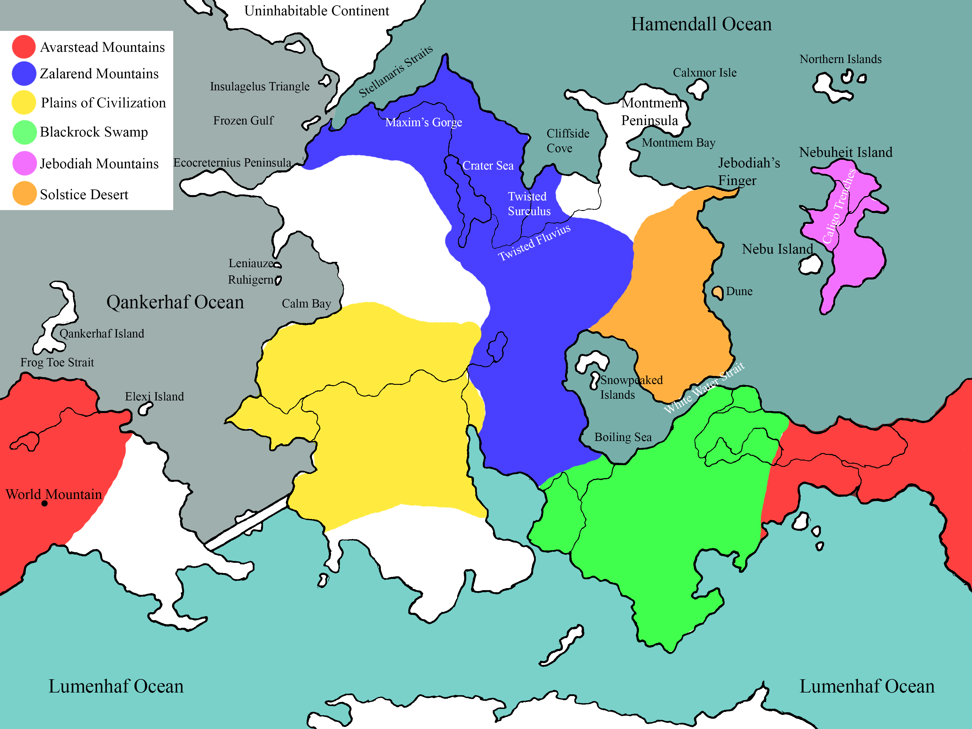
inkarnate and plate tectonics
I discovered Inkarnate thanks to some Pathfinder campaign work I was doing at the time for a group of friends. This powerful tool gave me the freedom to focus on making a beautiful map instead of the tedium of layers and making my own art.
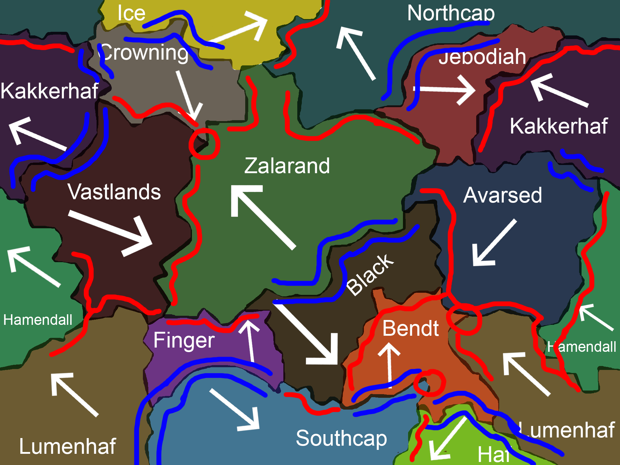
I drew out my landmasses in roughly the same shape as the original with some modifications, such as a second continent. Then, I created a map for the plate tectonics to inform the rest of my geography, ensuring major features matched existing lore.
refining landmasses and climate
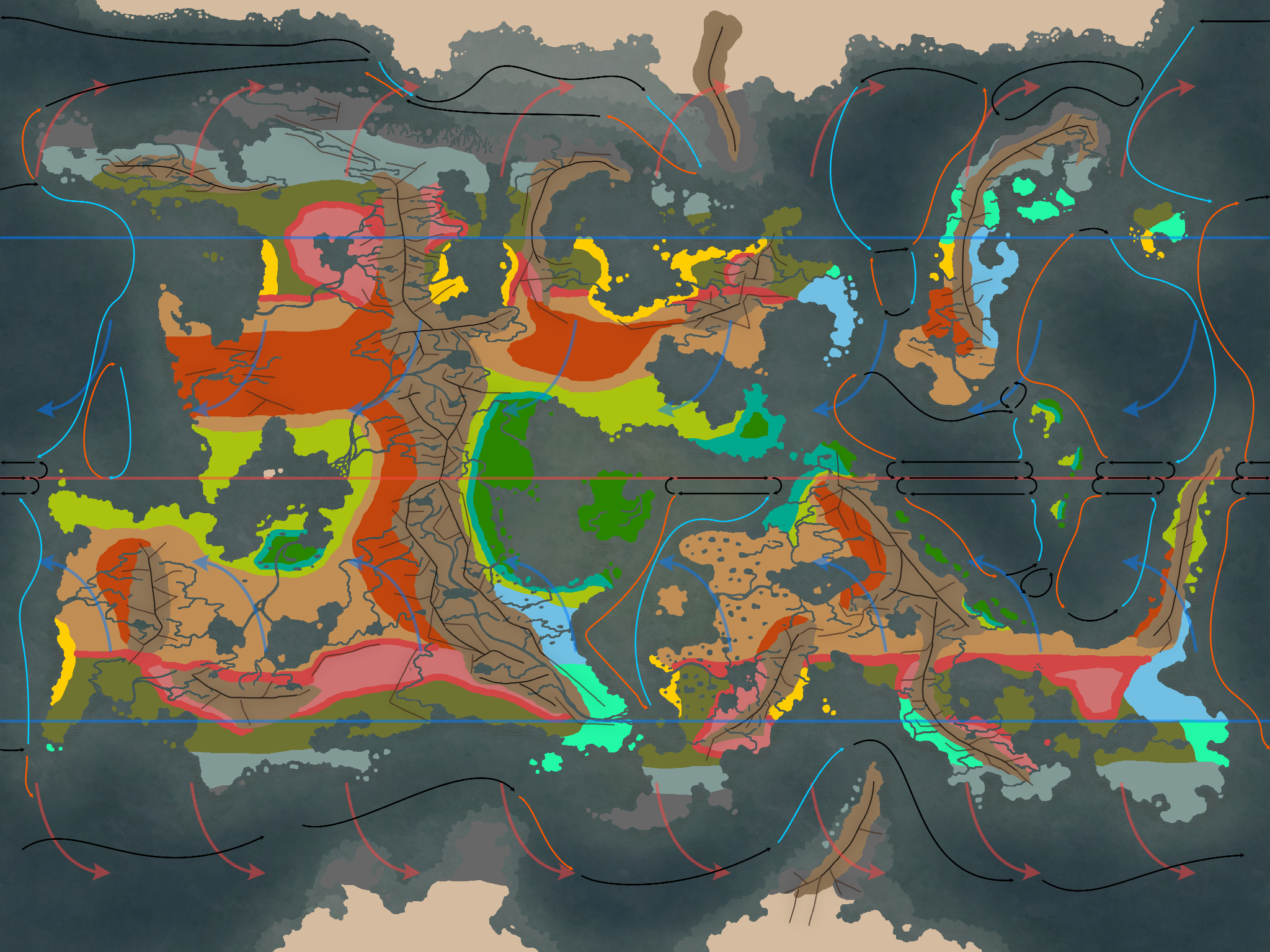
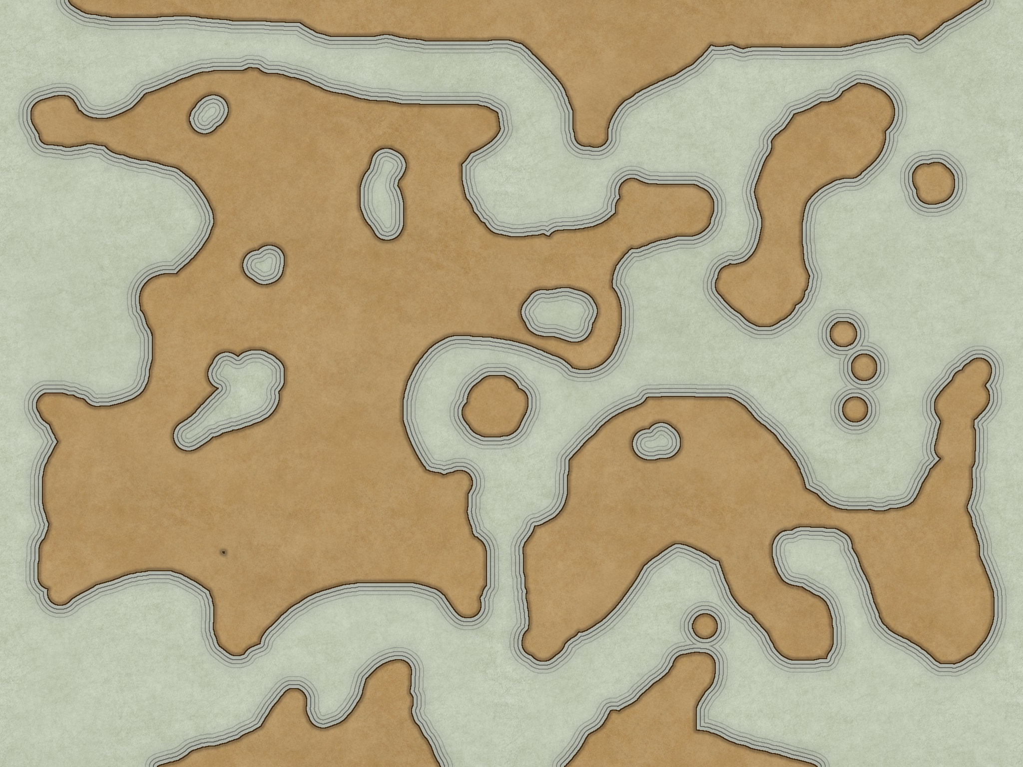
I began to refine the geography using the plate tectonics as reference. I decided where mountains would be, rivers would flow, lakes would pool, and so on. I added a huge amount of detail to the coasts with islands, believable erosion, and a continental shelf.
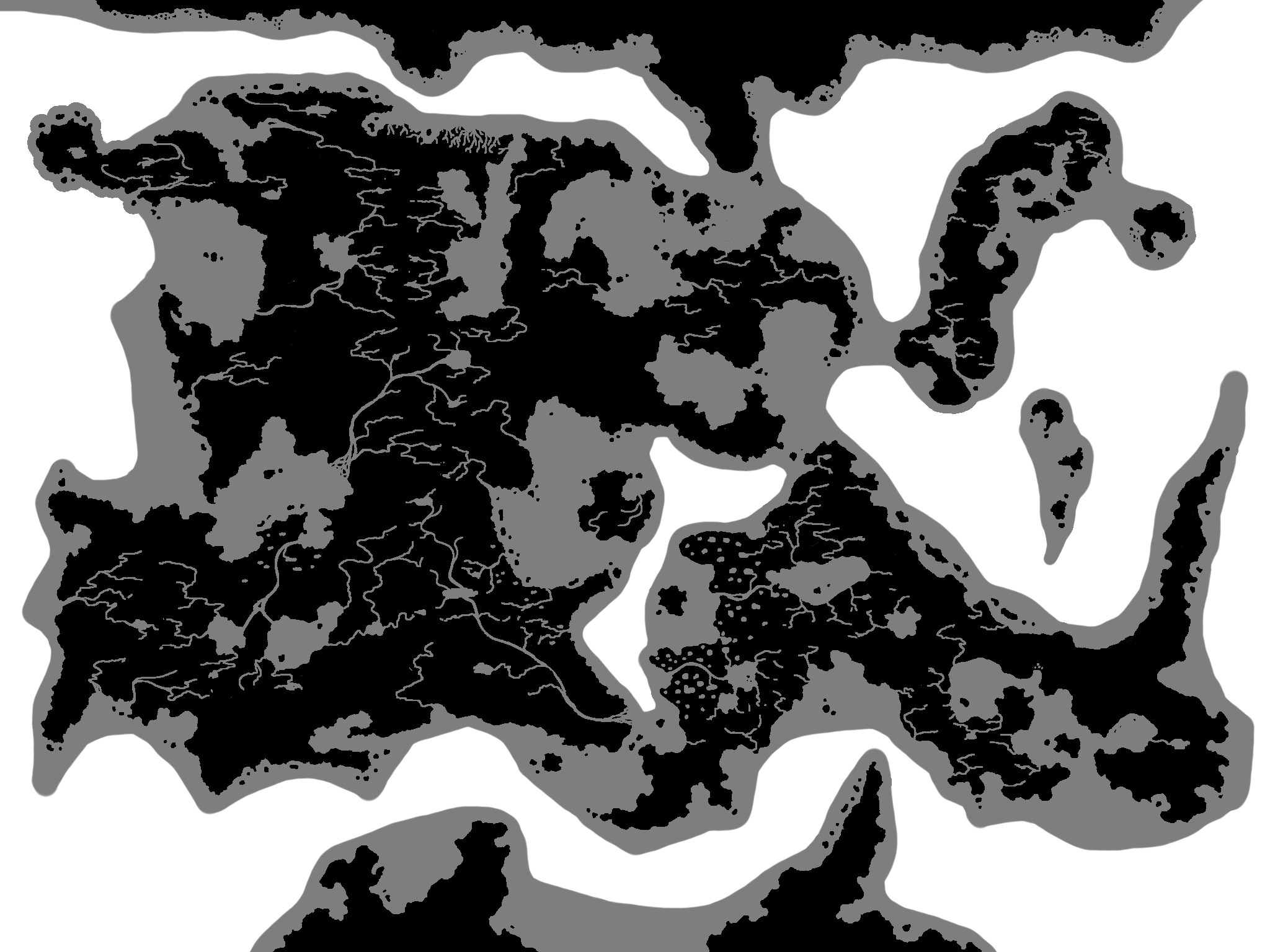
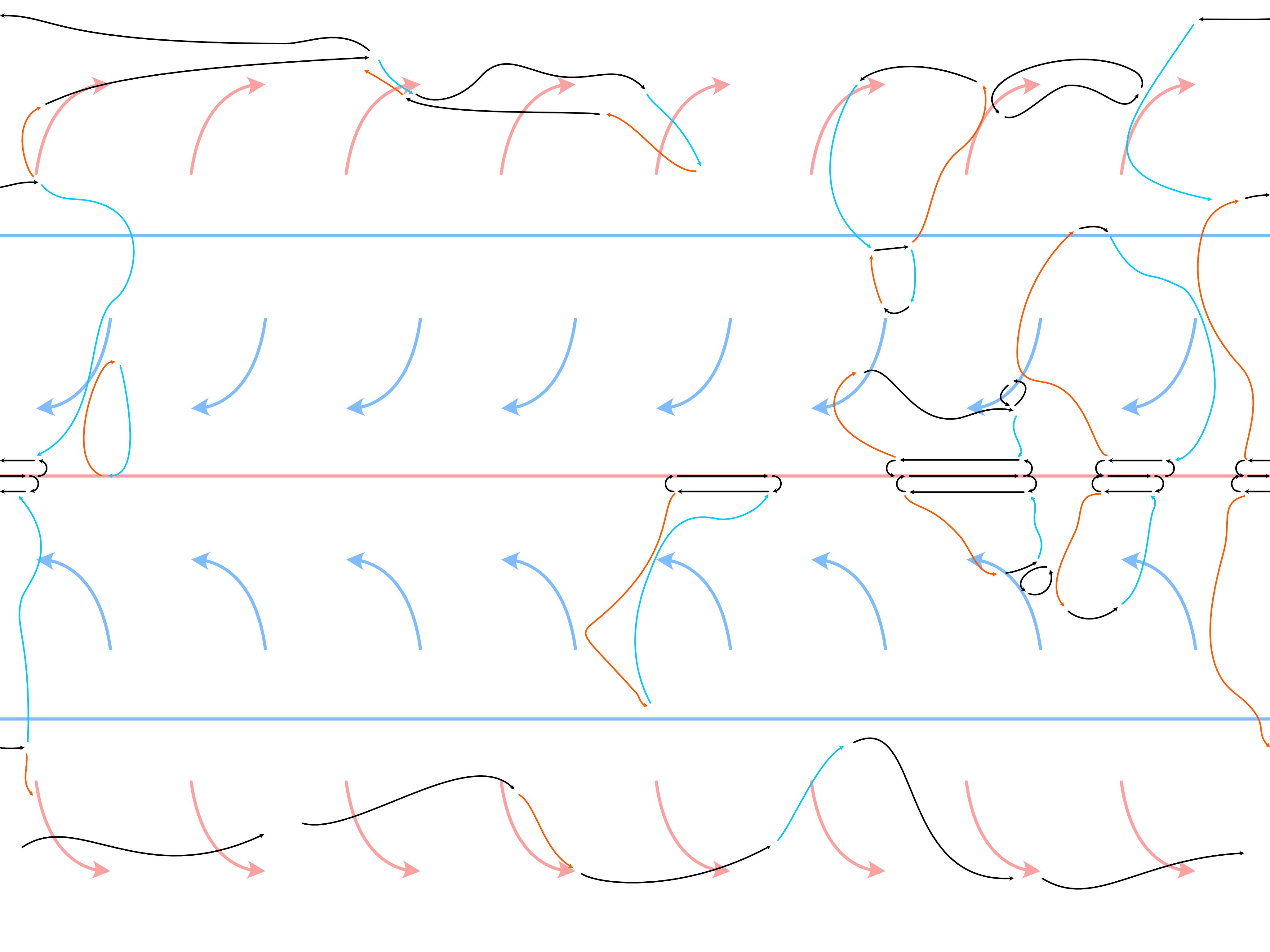
Afterward, with the help of hours of research, I created a realistic ocean current map which informed the climate map. This detailed climate map has become invaluable to ongoing worldbuilding.
final touches
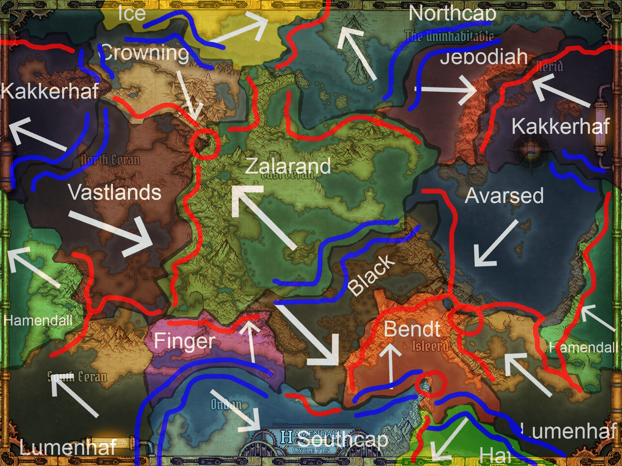
With the landmasses and climates locked in, I got to work on my major features such as mountains. I then painted in my distinct climate zones, keeping the colors varied enough to be interesting, but subtle enough to maintain the old-world aesthetic I was going for.
I double checked this against the plate tectonics to ensure it was all still feasible, then I finished out the map with detailed vegetation and atmospherics. Finally, I created custom city icons to match the world of Hamendall and placed them to finish the map off.